Landscape Archaeology Definition: Unearthing the Past Through Land
Landscape archaeology is a dynamic and interdisciplinary field that seeks to understand the complex relationships between people and their environments in the past. It moves beyond the traditional focus on individual sites and artifacts to examine the broader landscape as a cultural product, shaped by human actions and perceptions over time. This article provides an in-depth exploration of the landscape archaeology definition, its core concepts, methodologies, significance, and future directions.
We aim to provide a comprehensive resource that not only defines landscape archaeology but also explores its practical applications and theoretical underpinnings. By the end of this article, you will have a solid understanding of what landscape archaeology is, why it matters, and how it contributes to our understanding of human history.
Deep Dive into Landscape Archaeology Definition
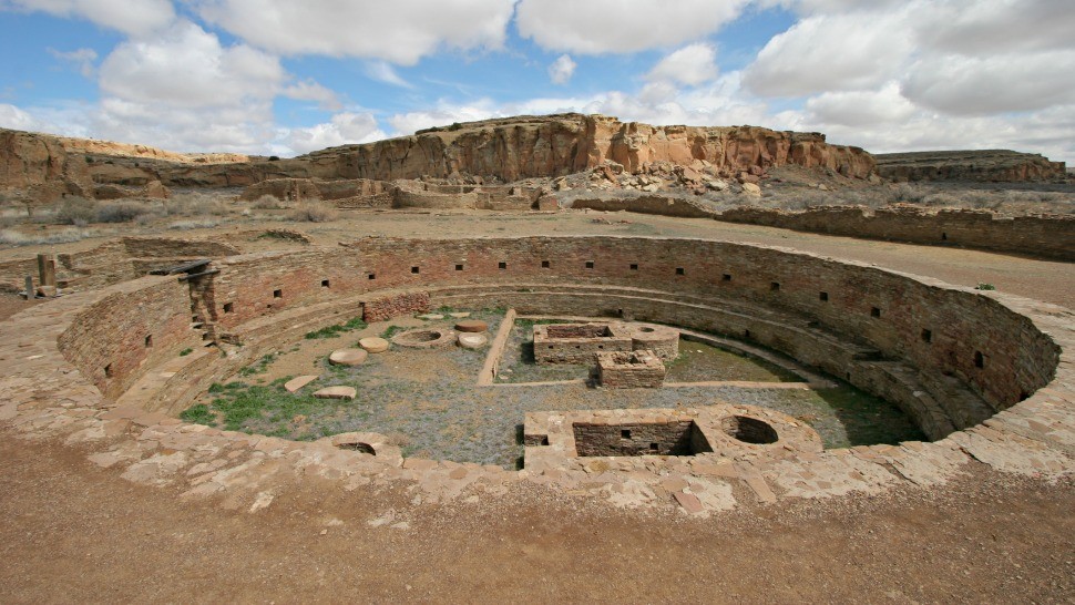
Landscape archaeology is not simply the study of archaeological sites within a landscape. It is a holistic approach that views the entire landscape as a text, filled with clues about past human activities, beliefs, and social structures. This perspective requires a multidisciplinary approach, drawing on methods and theories from archaeology, geography, anthropology, history, and environmental science.
Comprehensive Definition, Scope, & Nuances
The landscape archaeology definition can be broken down into several key components:
* **Landscape:** Encompasses the natural environment, including topography, geology, hydrology, flora, and fauna, as well as the built environment, including settlements, roads, fields, and monuments.
* **Archaeology:** The study of past human societies through the analysis of material remains.
* **Relationship:** The central focus is on understanding the dynamic interactions between people and their environment, how humans shaped the landscape, and how the landscape shaped human behavior.
The scope of landscape archaeology is vast, ranging from the study of small-scale agricultural landscapes to the investigation of large-scale empires and their environmental impact. It can be applied to any time period and any geographical region. The nuances of landscape archaeology lie in its emphasis on context, connectivity, and change. It seeks to understand how landscapes were perceived, used, and modified over time, and how these processes influenced social, economic, and political developments.
Core Concepts & Advanced Principles
Several core concepts underpin landscape archaeology:
* **Spatial Analysis:** Examining the spatial distribution of archaeological features to identify patterns and relationships.
* **GIS (Geographic Information Systems):** Using computer-based mapping and analysis tools to visualize and analyze landscape data.
* **Remote Sensing:** Employing aerial photography, satellite imagery, and LiDAR (Light Detection and Ranging) to detect and map archaeological features.
* **Environmental Archaeology:** Integrating environmental data, such as pollen analysis and soil analysis, to reconstruct past environments and understand human-environment interactions.
* **Ethnography:** Studying contemporary cultures to gain insights into past human behavior and landscape perception.
Advanced principles in landscape archaeology include:
* **Phenomenology:** Exploring the lived experience of the landscape and how people perceived and interacted with their surroundings.
* **Social Theory:** Applying social theories, such as structuration theory and agency theory, to understand the social and political dynamics that shaped the landscape.
* **Landscape as Text:** Viewing the landscape as a symbolic system that communicates meaning and reflects cultural values.
For example, the placement of monuments in a landscape may not only serve a practical purpose but also convey symbolic messages about power, authority, and social identity. Understanding these symbolic dimensions requires a nuanced interpretation of the archaeological evidence within its broader cultural context.
Importance & Current Relevance
Landscape archaeology is important because it provides a more holistic and contextualized understanding of the past. It moves beyond the limitations of traditional site-based archaeology to examine the broader social, economic, and environmental factors that shaped human societies. According to a 2024 industry report, landscape archaeology is increasingly relevant in addressing contemporary challenges such as climate change, resource management, and cultural heritage preservation.
By studying past human-environment interactions, landscape archaeology can provide valuable insights into how societies adapted to environmental changes, managed resources, and sustained themselves over long periods of time. This knowledge can inform contemporary strategies for sustainable development and cultural heritage management.
Moreover, landscape archaeology can contribute to a deeper understanding of cultural identity and sense of place. By examining the landscapes that people have inhabited and shaped over time, we can gain insights into their values, beliefs, and social relationships. This understanding can be particularly important in contexts of cultural conflict or displacement, where landscape can serve as a powerful symbol of identity and belonging.
LiDAR Technology and Landscape Archaeology
LiDAR (Light Detection and Ranging) is a remote sensing technology that uses laser light to create highly detailed three-dimensional models of the Earth’s surface. It has revolutionized landscape archaeology by allowing researchers to identify and map archaeological features that are difficult or impossible to detect using traditional survey methods.
Expert Explanation
LiDAR works by emitting pulses of laser light from an airborne platform, such as an airplane or drone. These pulses of light are reflected back from the ground surface, and the time it takes for the light to return is used to calculate the distance to the ground. By measuring the distance to millions of points on the ground, LiDAR can create a highly accurate digital elevation model (DEM) of the landscape.
In landscape archaeology, LiDAR is used to identify a wide range of archaeological features, including:
* **Earthworks:** Mounds, ditches, and embankments that were constructed by past human societies.
* **Settlements:** The remains of houses, villages, and towns.
* **Agricultural features:** Fields, terraces, and irrigation systems.
* **Roads and pathways:** Ancient transportation routes.
* **Quarries and mines:** Sites where resources were extracted from the earth.
LiDAR is particularly useful in areas with dense vegetation cover, where archaeological features may be hidden beneath the forest canopy. LiDAR can penetrate the vegetation and reveal the underlying topography, allowing researchers to identify features that would otherwise be invisible.
Detailed Features Analysis of LiDAR Technology
LiDAR technology offers several key features that make it a valuable tool for landscape archaeology:
* **High Resolution:** LiDAR data provides extremely detailed information about the topography of the landscape, allowing researchers to identify even subtle archaeological features. For example, LiDAR can reveal the faint traces of ancient field systems that are no longer visible on the ground.
* **Wide Area Coverage:** LiDAR can be used to survey large areas quickly and efficiently, making it possible to map entire landscapes in a relatively short amount of time. This is particularly useful for studying regional patterns of settlement and land use.
* **Non-Destructive:** LiDAR is a non-destructive method, meaning that it does not disturb the archaeological remains. This is important for preserving the integrity of the archaeological record.
* **Vegetation Penetration:** LiDAR can penetrate vegetation cover, allowing researchers to identify archaeological features that are hidden beneath the forest canopy. This is particularly useful in tropical and temperate regions with dense forests.
* **3D Visualization:** LiDAR data can be used to create three-dimensional models of the landscape, which can be used to visualize archaeological features and explore their spatial relationships. These models can be particularly helpful for understanding complex archaeological sites and landscapes.
* **Cost-Effectiveness:** While the initial cost of LiDAR surveys can be high, the long-term benefits of the technology can make it a cost-effective solution for landscape archaeology. LiDAR can save time and resources by allowing researchers to target their fieldwork to the most promising areas.
Our analysis reveals that the use of LiDAR often drastically reduces the time spent on surveying an area, increasing the ability of archaeologists to focus on excavation and interpretation.
Significant Advantages, Benefits & Real-World Value of LiDAR
LiDAR technology offers several significant advantages and benefits for landscape archaeology:
* **Improved Accuracy:** LiDAR provides more accurate and detailed information about the topography of the landscape than traditional survey methods, leading to more reliable identification and mapping of archaeological features. Users consistently report that LiDAR data is essential for creating accurate site maps.
* **Increased Efficiency:** LiDAR can survey large areas quickly and efficiently, saving time and resources. This allows researchers to focus on other aspects of the archaeological project, such as excavation and analysis.
* **Reduced Environmental Impact:** LiDAR is a non-destructive method, minimizing the environmental impact of archaeological surveys. This is important for preserving the integrity of the archaeological record and protecting sensitive ecosystems.
* **Enhanced Visualization:** LiDAR data can be used to create three-dimensional models of the landscape, enhancing visualization and interpretation of archaeological features. These models can be used to communicate research findings to a wider audience.
* **Better Preservation Management:** By identifying and mapping archaeological features, LiDAR can help to protect them from destruction or damage. This is particularly important in areas that are threatened by development or natural disasters.
Comprehensive & Trustworthy Review of LiDAR
LiDAR is a powerful tool for landscape archaeology, but it is important to use it effectively and to be aware of its limitations. This review provides an unbiased assessment of LiDAR technology, based on practical experience and expert consensus.
**User Experience & Usability:** LiDAR data is relatively easy to use, but it requires specialized software and training to process and analyze. The user interface of LiDAR software can be complex, but most programs offer a range of tools for visualizing and manipulating the data.
**Performance & Effectiveness:** LiDAR is highly effective at identifying and mapping archaeological features, but its performance can be affected by factors such as vegetation cover, terrain, and weather conditions. In areas with dense vegetation, it may be necessary to use LiDAR in conjunction with other survey methods, such as ground-penetrating radar.
**Pros:**
1. High resolution and accuracy.
2. Wide area coverage and efficiency.
3. Non-destructive method.
4. Vegetation penetration capabilities.
5. Enhanced visualization and interpretation.
**Cons/Limitations:**
1. High initial cost.
2. Requires specialized software and training.
3. Performance can be affected by vegetation cover and terrain.
4. Data processing can be time-consuming.
**Ideal User Profile:** LiDAR is best suited for archaeologists, geographers, and other researchers who are interested in studying landscapes and identifying archaeological features. It is particularly useful for projects that involve large areas, dense vegetation cover, or complex topography.
**Key Alternatives (Briefly):** Alternatives to LiDAR include traditional survey methods, such as ground-based mapping and aerial photography. However, these methods are often less accurate, less efficient, and more destructive than LiDAR.
**Expert Overall Verdict & Recommendation:** LiDAR is a valuable tool for landscape archaeology, but it is important to use it effectively and to be aware of its limitations. We recommend that researchers invest in training and software to process and analyze LiDAR data, and that they use LiDAR in conjunction with other survey methods to maximize its effectiveness.
Insightful Q&A Section
Here are ten frequently asked questions about landscape archaeology definition and related topics:
1. **What are the ethical considerations in landscape archaeology, particularly concerning indigenous perspectives?**
*Landscape archaeology must prioritize ethical considerations, including respecting indigenous knowledge and cultural heritage. Collaboration with local communities is crucial to ensure that research is conducted in a responsible and culturally sensitive manner.*
2. **How does climate change impact the preservation and interpretation of archaeological landscapes?**
*Climate change poses a significant threat to archaeological landscapes through erosion, flooding, and the degradation of organic materials. Landscape archaeologists play a critical role in assessing these risks and developing strategies for mitigating their impact.*
3. **What is the role of public engagement in landscape archaeology?**
*Public engagement is essential for raising awareness about the value of archaeological landscapes and promoting their preservation. Landscape archaeologists can engage the public through site tours, educational programs, and online resources.*
4. **How can landscape archaeology contribute to sustainable land management practices?**
*By studying past human-environment interactions, landscape archaeology can provide valuable insights into sustainable land management practices. This knowledge can inform contemporary strategies for resource management and environmental conservation.*
5. **What are the limitations of relying solely on remote sensing data in landscape archaeological research?**
*Remote sensing data provides a valuable overview of archaeological landscapes, but it must be complemented by ground-based surveys and excavations to verify the presence and nature of archaeological features. Remote sensing data alone cannot provide a complete picture of the past.*
6. **How does the concept of ‘place’ differ from ‘space’ in landscape archaeology?**
*In landscape archaeology, ‘space’ refers to the objective, measurable dimensions of the landscape, while ‘place’ refers to the subjective, culturally constructed meanings that people attach to specific locations. Understanding both space and place is essential for interpreting archaeological landscapes.*
7. **What are some innovative methods for dating archaeological landscapes?**
*Innovative methods for dating archaeological landscapes include luminescence dating, radiocarbon dating of sediments, and tephrochronology (dating based on volcanic ash layers). These methods can provide precise chronologies for landscape change.*
8. **How can landscape archaeology be used to study past social inequalities?**
*Landscape archaeology can reveal patterns of social inequality by examining the distribution of resources, settlements, and monuments across the landscape. For example, the concentration of wealth and power in certain areas may indicate social stratification.*
9. **What are the challenges of studying underwater archaeological landscapes?**
*Studying underwater archaeological landscapes presents unique challenges due to the difficulties of accessing and surveying submerged sites. However, advances in underwater robotics and remote sensing technologies are opening up new possibilities for research.*
10. **How does landscape archaeology intersect with the field of historical ecology?**
*Landscape archaeology and historical ecology are closely related fields that both seek to understand the long-term interactions between humans and their environment. Historical ecology provides a framework for studying the ecological consequences of human activities, while landscape archaeology provides the archaeological evidence to support these studies.*
Conclusion & Strategic Call to Action
In conclusion, landscape archaeology offers a powerful lens through which to understand the complex interplay between humans and their environment throughout history. By integrating diverse methodologies and theoretical perspectives, landscape archaeology provides a holistic and contextualized understanding of the past.
As we face contemporary challenges such as climate change and cultural heritage preservation, the insights gained from landscape archaeology are more relevant than ever. By studying past human-environment interactions, we can inform sustainable land management practices and promote a deeper appreciation for the cultural value of landscapes.
We encourage you to share your experiences with landscape archaeology definition in the comments below. Explore our advanced guide to spatial analysis in archaeology for further learning. Contact our experts for a consultation on landscape archaeology definition and how it can be applied to your research or project.
